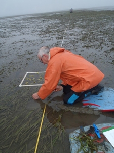
CDFW photo by A. Frimodig
This is a special, two-part installment of the California Department of Fish and Wildlife series, Exploring California’s Marine Protected Areas. Part One investigates what makes this bit of estuary special and the protections in place to safeguard it, while Part Two will take an inside look at research under way in the bay.
Situated along the rugged coastline of northern California and adjacent to the coastal towns of Eureka and Arcata, Humboldt Bay is the Golden State’s second largest estuary. One of approximately 116 estuaries statewide, it encompasses about 28 square miles, and is second in size only to San Francisco Bay.

photo by F. Shaughnessy
A wide array of coastal habitats in northern California are broadly considered estuaries – from brackish lagoons that breach every several years, to embayments like Humboldt Bay that are dominated by oceanic conditions, to actual estuaries with strong oceanic and watershed connections. As a group, they are among the most dynamic and productive ecosystems in the world. In Humboldt Bay alone, natural marine resources include habitats such as eelgrass, salt marsh, and an extensive system of tidal mudflats and channels that support marine invertebrates, marine and anadromous fishes, shorebirds, waterfowl, seabirds, and marine mammals. In fact, according to the California Department of Fish and Wildlife (CDFW) Marine Region Geographic Information System Lab, Humboldt Bay contains about 34 percent of the known eelgrass in all of California, and southern Humboldt Bay is regarded as one of the most significant locations of eelgrass growth on the entire West Coast of the United States. Certain areas in and around Humboldt Bay have been specially designated to protect the diverse wildlife in the estuary. For example, the Humboldt Bay National Wildlife Refuge was established in 1971 to preserve and enhance migratory birds and their habitats. More recently, in December 2012, the South Humboldt Bay State Marine Recreational Management Area (SMRMA) was created in the southwest portion of Humboldt Bay.

map by CDFW Marine Region GIS Lab
But what exactly is a SMRMA (other than being fun to say out loud – [smur–muh])? A SMRMA is a marine managed area designation used in California to prohibit any activity that would compromise the recreational values for which the area may be designated. The South Humboldt Bay SMRMA protects an area of 0.8 square miles and prohibits the take of all marine resources except waterfowl hunting, and take exemptions for members of the Wiyot Tribe – a federally recognized California Tribal government and people that have lived in the Humboldt Bay region for thousands of years. Popular non-extractive recreational activities in Humboldt Bay, including boating, wildlife viewing, kayaking, rowing, paddle-boarding, and interpretation/education activities, are allowed in South Humboldt Bay SMRMA.
South Humboldt Bay SMRMA is one of three estuarine marine protected areas (MPAs) on the north coast where research is under way as part of California’s MPA Baseline Monitoring Program, administered by CDFW, the Ocean Protection Council, Ocean Science Trust, and California Sea Grant through four collaborative regional programs. Read about the research under way in South Humboldt Bay SMRMA in the next installment of Exploring California’s Marine Protected Areas!
post by Adam Frimodig, CDFW Environmental Scientist
Learn more about MPAs by diving into the Exploring California’s Marine Protected Areas series!


One thought on “Exploring California’s Marine Protected Areas: South Humboldt Bay State Marine Recreational Management Area (Part One)”
Comments are closed.